South Devon Railway
Rattery
In which Joe thinks a third time about which is the most obscure engine house on any atmospheric railway, but has no doubt of the most peculiar name.
Explorations: 21 October 2019.
Journey: Paddington to Plymouth.
-
OFTEN CITED REFERENCES
- Paul Garnsworthy, editor, Brunel's Atmospheric Railway, The Broad Gauge Society, 2013.
- Peter Kay, Exeter–Newton Abbot: a Railway History, Platform 5, 1991, and excerpts in Garnsworthy.
- Howard Clayton, The Atmospheric Railways, the author, 1966.
- Charles Hadfield, Atmospheric Railways, David and Charles, 1967.
- G.A. Sekon, A History of the Great Western Railway, Digby, Long, 1895.
The eleventh engine house on the South Devon Railway was in a rural area about a mile south of a village called Rattery. Construction of foundations began in January 1848, and the buildings may have been complete or nearly so when the Board voted in August to discontinue atmospheric operation. Work continued so late mainly because of the idea of using atmospheric assist on the inclines, which was also discarded. The Rattery site is near the top of Rattery Bank, rated as the seventh steepest in Great Britain, four and a quarter miles of varying inclines up to 2.2%. The summit is almost a mile farther on a much easier grade, at the west end of Marley Tunnel.
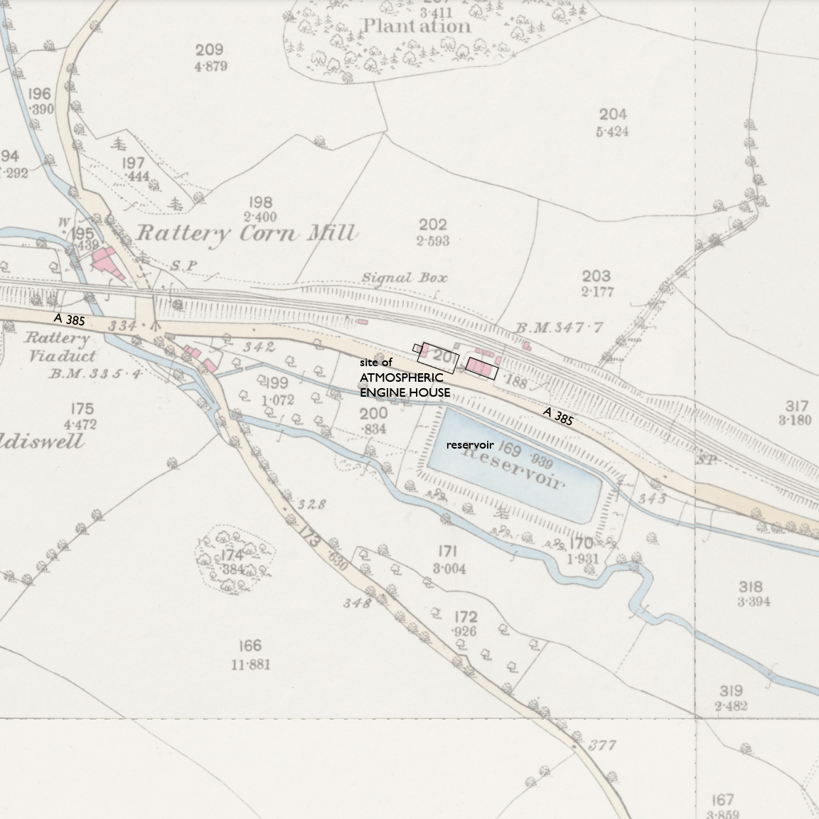
— Rattery, Ordnance Survey 25-inch, 1890. CC BY-NC-SA 4.0 courtesy National Library of Scotland.
Annotations by Joseph Brennan.
The site of Rattery engine house was considered unknown as late as Peter Kay's book in 1991. As you can see above, the "reservoir" should have been a clue, along with the masonry buildings nearby between the road and railway. A viaduct and a corn mill named Rattery confirm the use of the place name this far from the village.
Before I secured a copy of Brunel's Atmospheric Railway I studied Google Streetview for any clues. About a half mile east of the correct location, the A385 is at the same level as the parallel railway and there is open ground between them owned by Network Rail. That looked like a pretty good candidate to me, and I only needed confirmation.
But then I looked some more. The reservoir is now one of several pools of a business called Hatchlands Trout Farm, so the pool itself did not ring bells. But what is across the road did. Below, we are looking north from the A385 toward the railway.
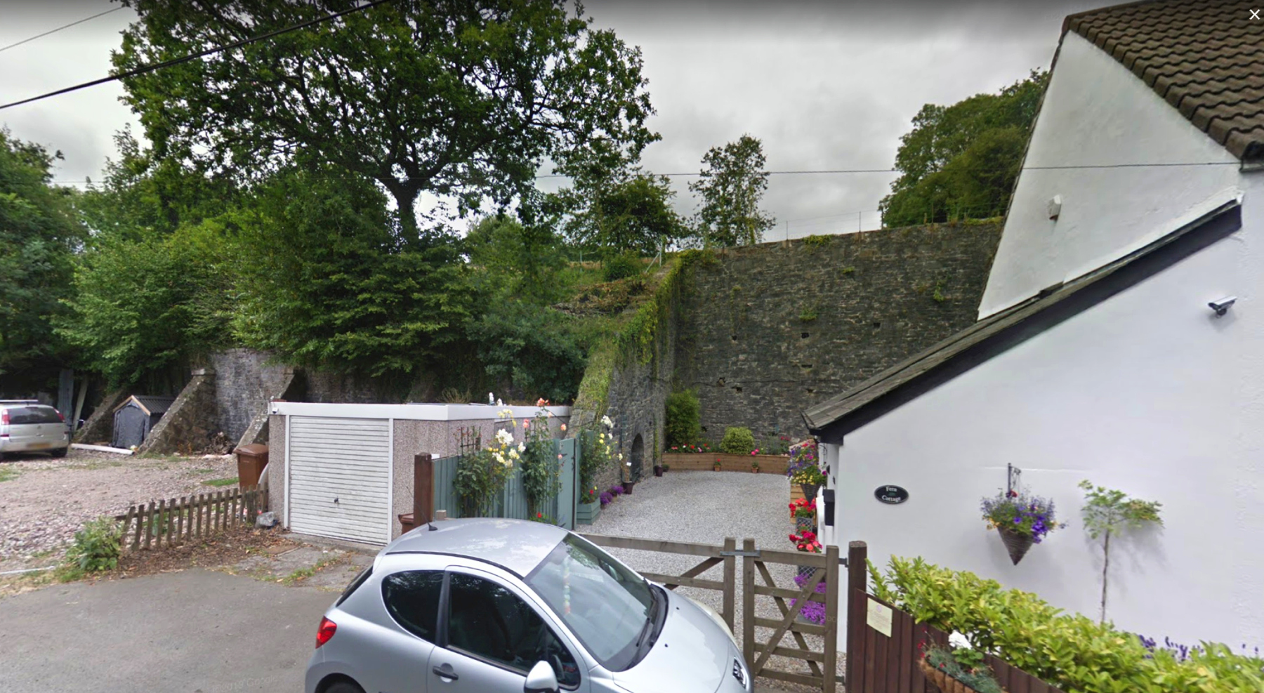
— Image capture: Jul 2019, © Google
Railway embankments normally have a slope of earth on the side, not stone walls propped up by buttresses. Clearly space was being made here for buildings at the level of the road, buildings of which there is no trace, unless these walls were part of them. The situation is like that at Dawlish, except that there the railway itself is at the bottom of the wall.
The team who produced the Brunel's Atmospheric Railway book scored a breakthrough in 2012. When they visited the site, they happened to meet the owner of one the two white-walled attached cottages, who invited them to walk into the grounds. It is impossible to see this from the road, and it is obscured by trees from the railway, but the back left corner of the cottages is "the big discovery of the visit — the surviving north-west corner of the engine room, with the unmistakable features of random squared limestone walling, large limestone quoins, and Italianate window surrounds in Bath stone." In fact most of the rear wall is there, although the rest of the building was demolished for construction of the cottages.
In the image above, to the left is remains of the boiler house. The team found that the arch in the wall opens to a shaft in which coal wagons would be lowered from railway level. To the left of that, what is now the embankment wall was the north wall of the boiler house, with buttresses added when the building was demolished. Lastly the team found the base of the chimney on the west end of the boiler house site.
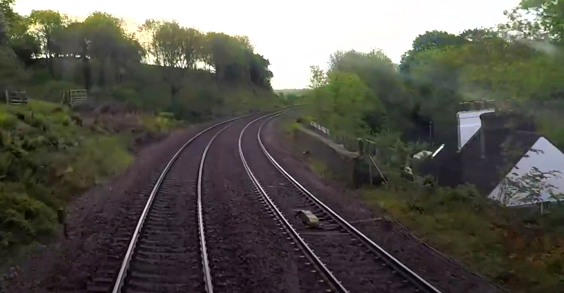
— "The Last Day of the High Speed Train, Plymouth to London", screen cap at 28:06, from Great Western Railway, 18 May 2019.
The back wall is not visible from the driver's eye view above, and the top of the retaining wall may partially block the view down from the side window of a train. Trains pass here at a high speed so the chances of a glimpse look slim.