Dublin and Kingstown Railway
Dalkey
In which Joe describes the later history of the atmospheric railway line, and takes a journey through the past near its Dalkey terminal, with old and modern illustrations, including a look at an existing bridge from the atmospheric age, and ends with a few words about Saint Begnet.
Explorations: Thursday, 21 June 2018, and Tuesday, 15 October 2019
Journey: Dublin Pearse to Dalkey, DART
or stop by Dún Laoghaire first and then continue to Dalkey.
-
OFTEN CITED REFERENCES
- Howard Clayton, The Atmospheric Railways, the author, 1966.
- Charles Hadfield, Atmospheric Railways, David and Charles, 1967.
- Rob Goodbody, The Metals : from Dalkey to Dún Laoghaire, Dún Laoghaire Rathdown County Council, 2010.
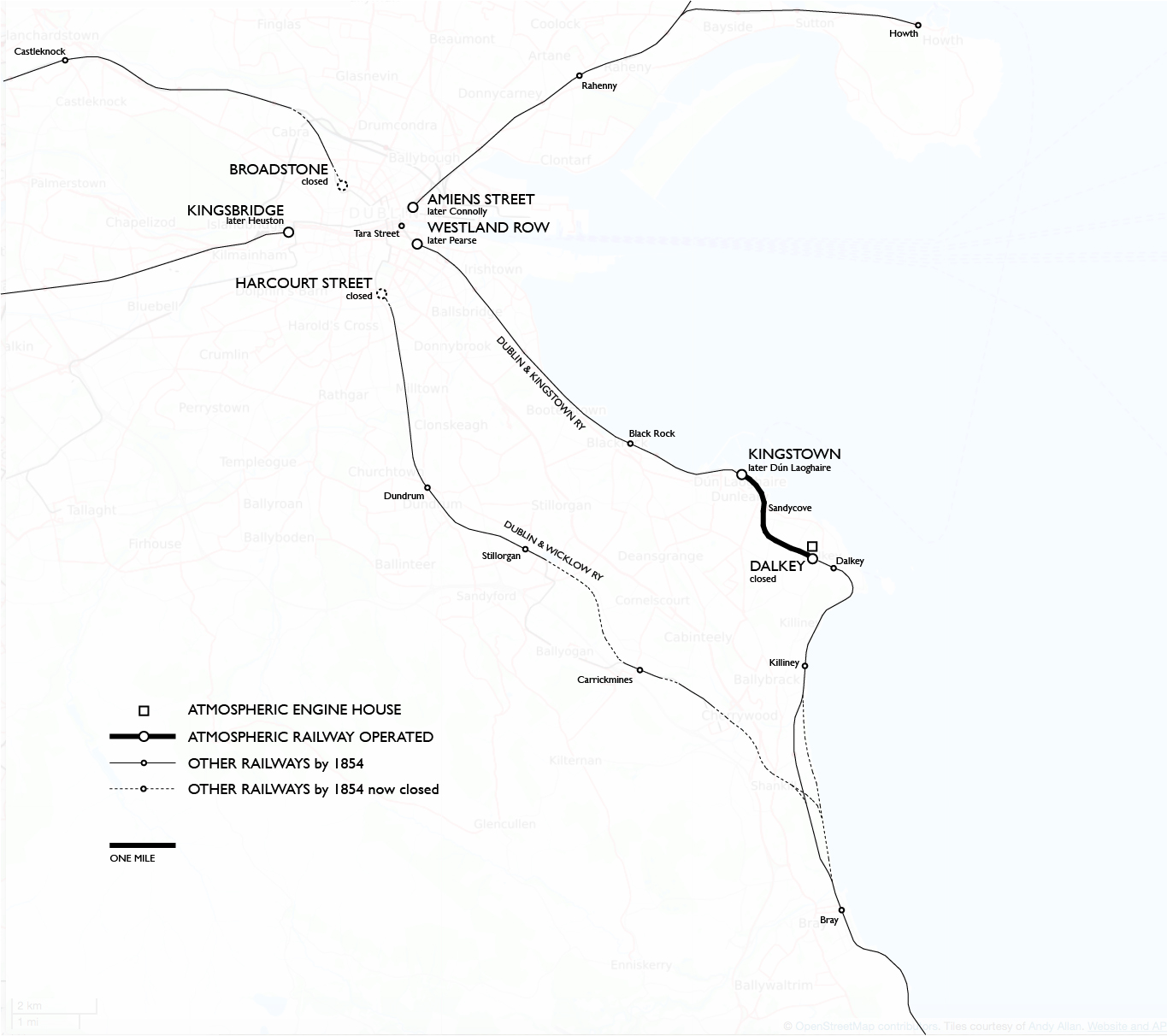
My description of the atmospheric railway between Dún Laoghaire (Kingstown) and Dalkey begins on the Dún Laoghaire page. Here we will examine the route of the railway over the years and take a walk near the Dalkey terminal.
The last atmospheric train to Dalkey ran on 12 April 1854. The transition to locomotives took more than two years, and further rebuilding for double track followed a decade and a half later. To understand what we will see at Dalkey, let's get a little historical background. For reference I will repeat here the map from the Dún Laoghaire page.
The Dublin and Kingstown Railway obtained powers as early as 1846 to continue down the coast to Bray. The descent back down to sea level would be another steep grade ideal for atmospheric working, but the transfer of the powers that same year to the newly created Waterford, Wexford, Wicklow, and Dublin Railway suggests that other plans were already in the works. The WWW&DR was authorized to build new from Kingstown to Bray, as if the atmospheric route might not even be used. On 10 July 1854 the renamed Dublin and Wicklow Railway opened their inland main line from Dublin Harcourt Street to Bray, and also a branch from Dalkey (modern station site) to join the main line near Bray. On 30 October the D&WR was completed to Wicklow.
Obviously the D&WR and D&KR were working together to establish a second main line via Kingstown, the most important intermediate point because of its maritime connections. As part of the plan the non-standard atmospheric section would be converted to locomotive working, which by that date, only ten years later, had been shown to be possible on a one per cent grade. The tougher two per cent, described as the last 400 yards, would be eased since the new railway would remain in cut through Dalkey.
The floor of the atmospheric railway cut needed to be lowered from its 8½ foot clearance under bridges in order to pass locomotive smokestacks. I suppose this was a drop of at least four feet, and I don't understand how it was done. My limited experience with old stonework makes me doubt that the original walls had footings very deep into the ground. At any rate by September 1855 an inspector for the Board of Trade reviewed the work and reported the new walls being in good condition. However he raised objections to sharp curves in the line and recommended against opening the railway to traffic in that condition.
The sharp curves were odd bends in otherwise broad curves that had not mattered on the low-speed truckway. At those locations the atmospheric had guard rails (on the inner side of the main rails), and at least on the ascending run, which was always done faster, the connection to the pipe probably helped guide the trains. Because the D&KR had avoided the need for Parliamentary permission by building within its own property and not crossing roads, the curves had not been subject to review before. The trouble was that the company's plan as now submitted to Parliament showed smoother curves. As a result of the objections the company were required to rebuild parts of the line a second time. They could at least use the completed track to carry stone and earth, and so the necessary work was done quickly. Locomotive trains finally began running from Westland Row through Dalkey to Bray on 1 July 1856. The day before, the D&WR leased the property of the D&KR.
One of the two problem spots particularly called out was north of Summerhill Road, where the railway takes a sweeping curve to run parallel to the coast in the approach to Kingstown station. In his The Metals Rob Goodbody reproduces an 1837 Ordnance Survey map, pre-dating the atmospheric, that shows a sudden change of curvature on the way to Windsor Terrace, but also an 1843 map with a somewhat less serious kink, a difference he does not remark upon. The 1866 Ordnance Survey map shows a reasonably smooth curve from the 1856 improvement, and yet it was rebuilt yet again in the 1880s.
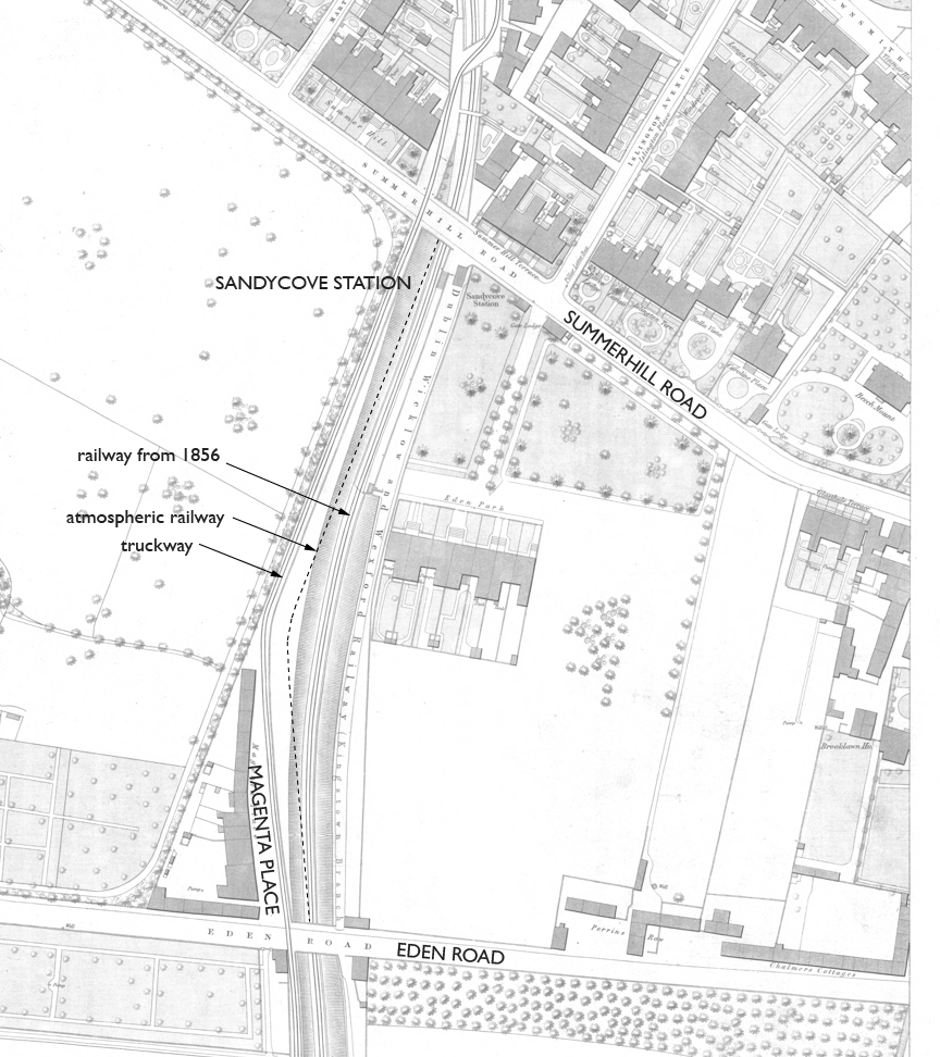
The other curve mentioned explicitly was the one at Magenta Place, seen in the map below. The base map shows the locomotive railway alignment completed in 1856, and I have added as a dashed line that of the atmospheric, taking a remarkably bad curve that is confirmed by the 1843 Ordnance Survey map reproduced in Rob Goodbody's book. I can't believe the company were ever happy with this spot, and I wonder whether the unsatisfactory construction of 1855 had not made some effort to improve it, even if it was not enough.
The map also shows the first intermediate station, Sandycove, which opened together with the start of locomotive service. The platform on the single track runs along the east side south of the little station house at Summerhill Road, and it seems to have another entrance from the Eden Park villas at the south end. (The other intermediate station at Glenageary is from 1867.)
Another curiosity on the map is truckway. Having started on the east side at Dalkey, it crossed to the west side by a wide skew bridge on the curve approaching Eden Road (south of this map area). You can see at the top of the map that it crossed back to the east side north of Summerhill Road by a similar bridge. In both cases the width allowed the track to make a workable reverse curve. The former bridge was replaced when the railway was widened in the 1880s, but the latter was not, because the truckway itself was relocated, complete with rails, to the west side. The footpath today is still on the west side.
In 1862 the D&WR reported having double track from Harcourt Street to Bray and Westland Row to Kingstown. The former atmospheric was still single.
The second stage of rebuilding widened the line from Kingstown to Bray for two tracks. Most of it was in cut, and south of Dalkey there was a section in rock tunnel. It was expensive work that took from 1878 to 1882 to complete. There was also some further easing of curves in the process including the area north of Summerhill Road and most notably a straightening near Dalkey that we will examine. Of course I would like to know whether the company were frugal enough to leave one of the original atmospheric walls in place, or whether they rebuilt both in order to preserve the same center line. I don't know.
DALKEY
Let's study the site of the Dalkey terminal, and then we can set off to walk in the area. To begin, we have a drawing of the engine house.
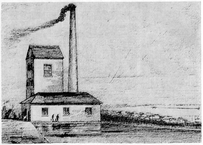
— original source unknown, via Charles Hadfield.
All of the atmospheric railway engine houses had this general design. The low building has the steam boilers, with water supply from a reservoir in the foreground, and the smokestack. The taller building next to it has the steam engine and the air pump. At Dalkey there were three boilers, 4 feet 3 inches in diameter and 38 feet in length. The engine powered by their steam had a cylinder 34½ inches in diameter and a stroke of 5 feet 6 inches, rotating an air pump 5 feet 7 inches in diameter. The flywheel was an enormous 36 feet in diameter. I have this detail from Kevin Murray's article "The Atmospheric Railway to Dalkey", in which he comments that the engine was "much too large" for "it could have operated a line three times the length of the Dalkey branch, and was never run at more than half its power." This generous provision would not always be the case on atmospheric railway installations.
When the iron cylinder of the air pump cracked in November 1848 the D&KR hastily converted their small locomotive Princess so that it could pass under the bridges, and it handled trains between Kingstown and Dalkey from 23 December until 5 February 1849. This experience inadvertently demonstrated that atmospheric propulsion was not needed to conquer the grade, at least not for the four-car trains that were adequate for winter passenger traffic.
The Ordnance Survey map dated 1843, below, shows the atmospheric railway. The "Engine Ho." is T-shaped with a round structure next to it, precisely the arrangement in the drawing. Around it on two sides is the reservoir, which appears to be in several sections. I don't know whether it had a source other than rain (not a rare event in Ireland). Across the end of the railway is a building called "Shed" which must be the Dalkey station. It is set well back from the road, possibly to deal with the occasions when the train overran the station!
Barnhill Road continues into the center of Dalkey, where it becomes Castle Street. The truckway crosses Barnhill Road at grade (as it crossed every street) and went a short distance around a curve to reach the bottom of incline number 3. There would be no purpose to extending the atmospheric under another road only to end at a location away from public roads or footpaths.
The map does not show clearly how the truckway passed the Shed, but there is space between the reservoir and the main part of the building, and where the building touches the reservoir there may have been just a roof over the truckway.
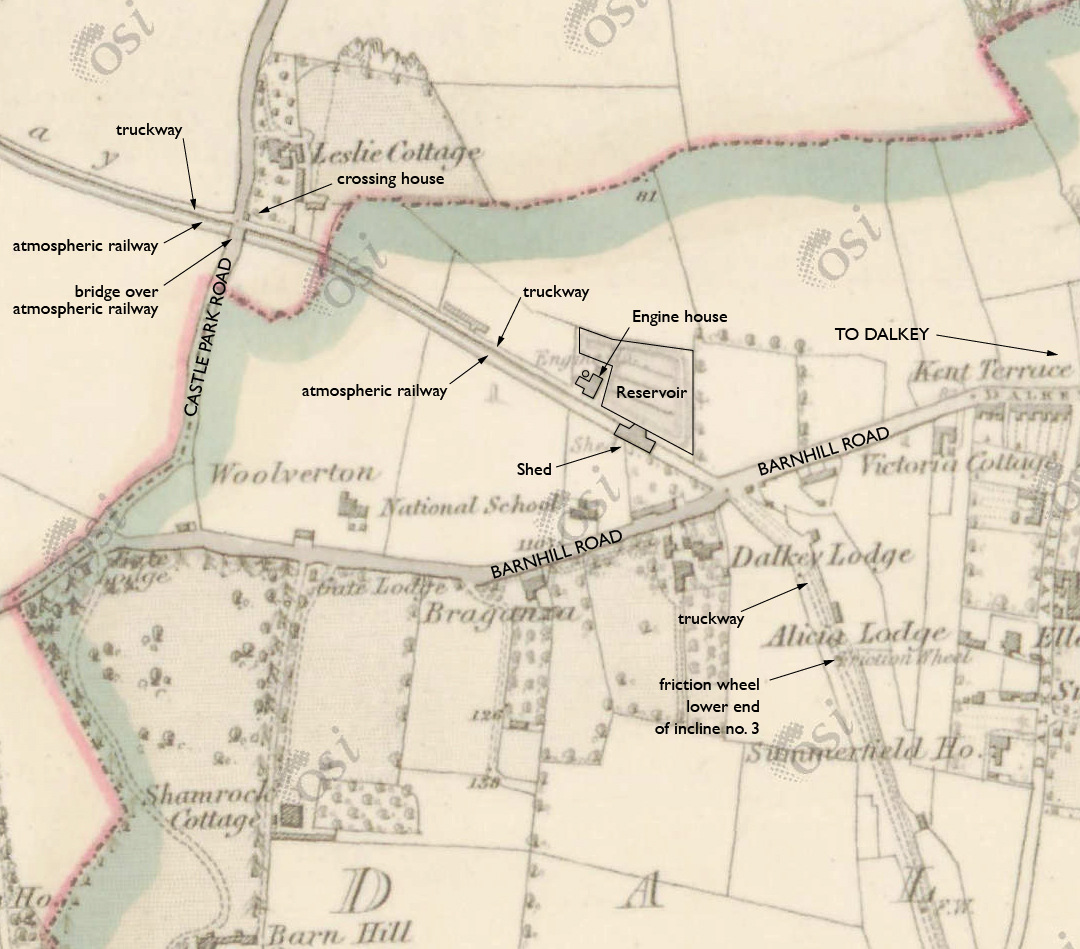
Notice on the map above that at Castle Park Road the atmospheric crosses under in a cut as the truckway crosses at grade. There is a small old house in the northeast corner that may have been the residence of a crossing guard. It's still there.
The map below is dated 1888, and it shows the changes after the railway was double tracked. There is no trace of the atmospheric engine house, reservoir, or shed, but nothing else has been built yet on the former property. The truckway begins now at Barnhill Road, because a quarry has broken into its old path to the south, on a site that is today a neighborhood of houses called Old Quarry.
(This map is at a larger scale, so enlarge as much as you can.)
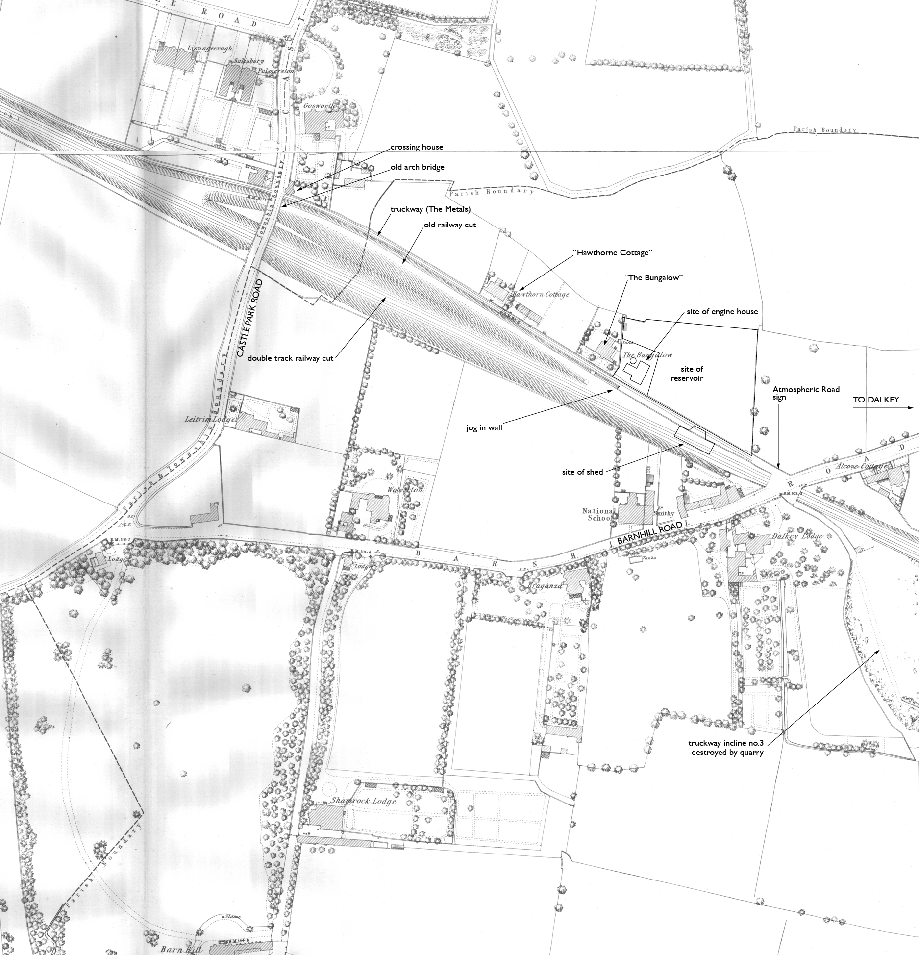
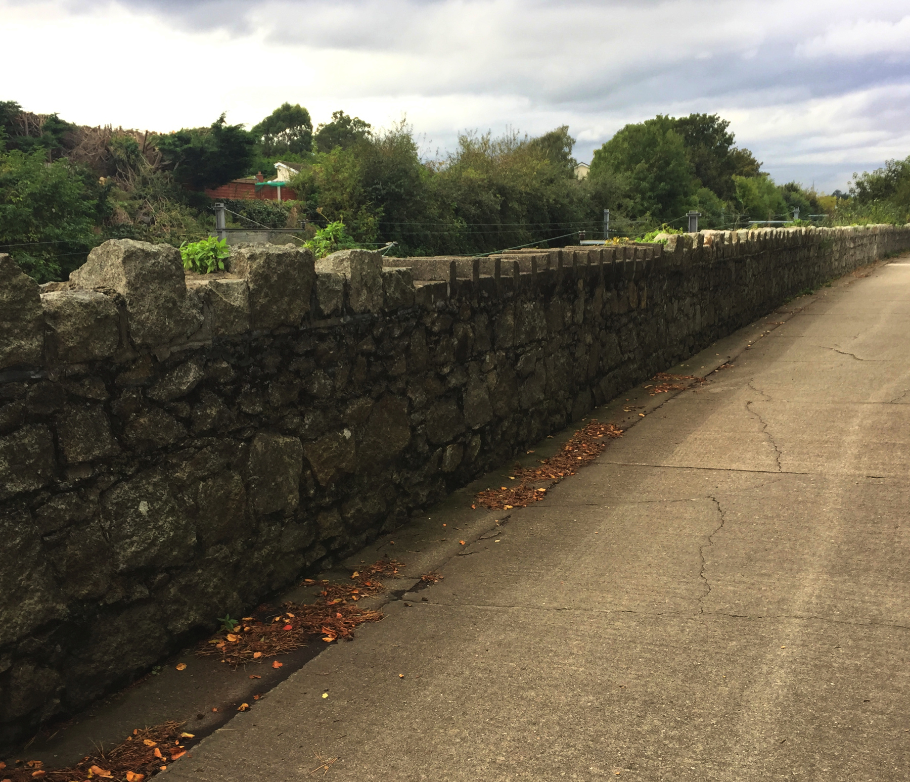
The big change here is the realignment of the railway near the upper end of the former atmospheric railway, done as part of the double track work. The curve here was gentle enough to pass muster in 1855, so the single track locomotive railway continued to run on the same path. Today, the cut has been filled in north of Castle Park Road and a private house stands on the site at street grade. But the rest of the old cut is still there. Growth of trees and other plants and standing water all make it almost impossible to see the old roadbed that is still there.
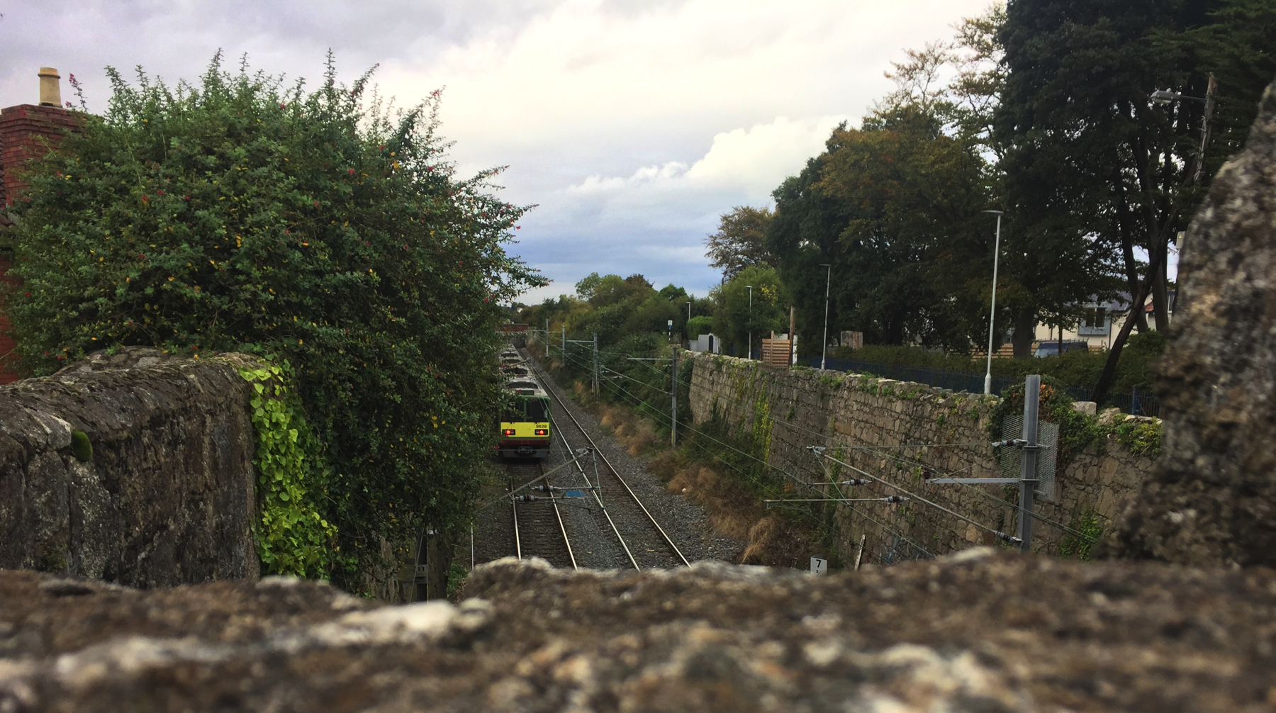
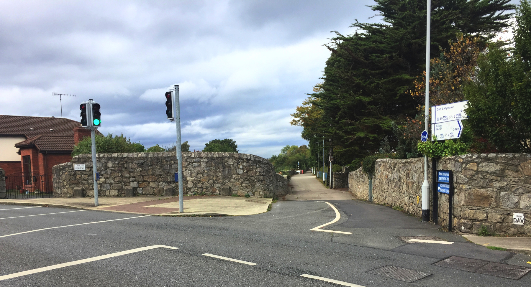
Let's start at Barnhill Road bridge. A DART train is moving away to the north. You can see that the stone wall curves away on the right where the railway used to go. Note the location of the horizontal wood slats and the door in the white wall— we'll see them closer up in a few moments.
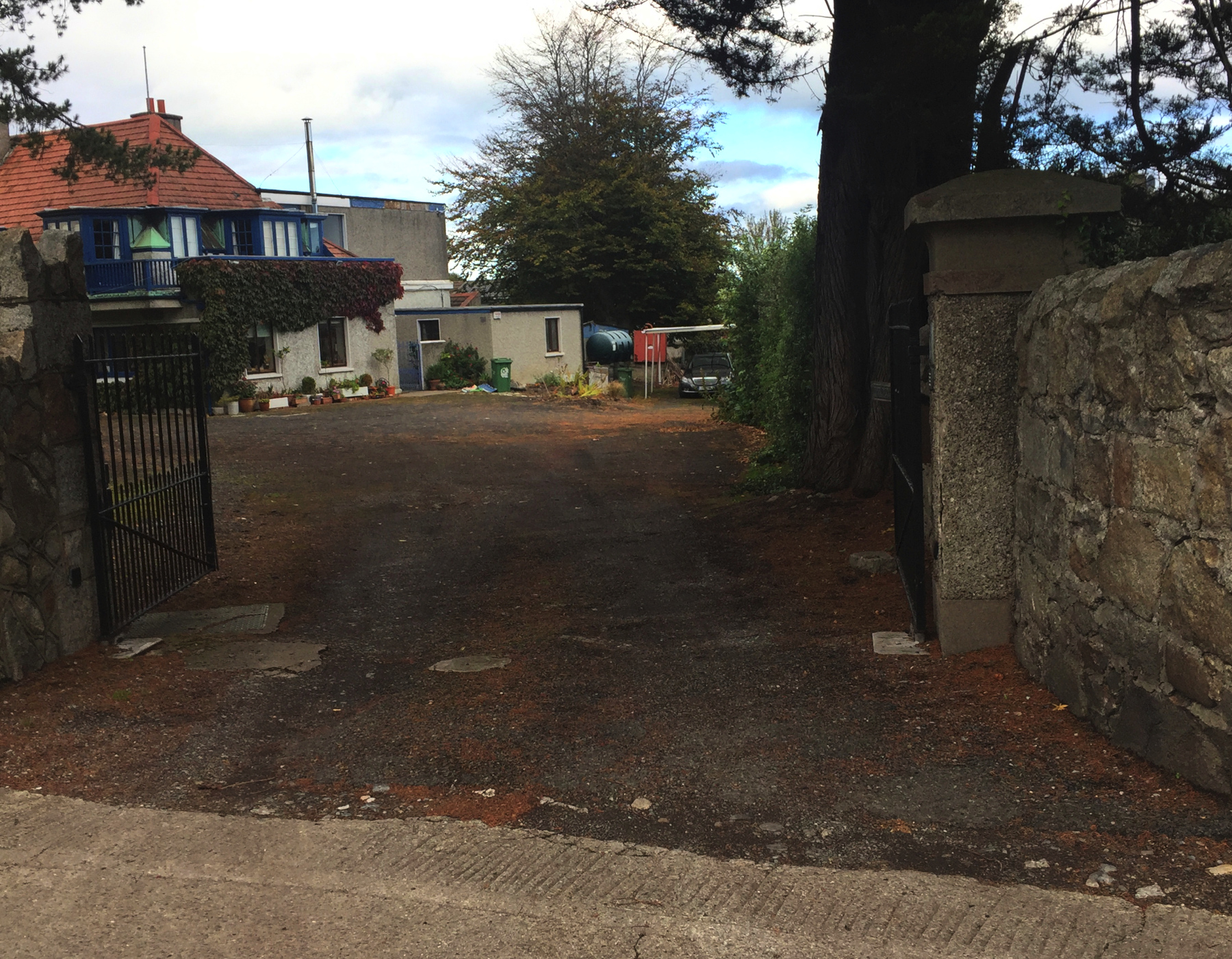
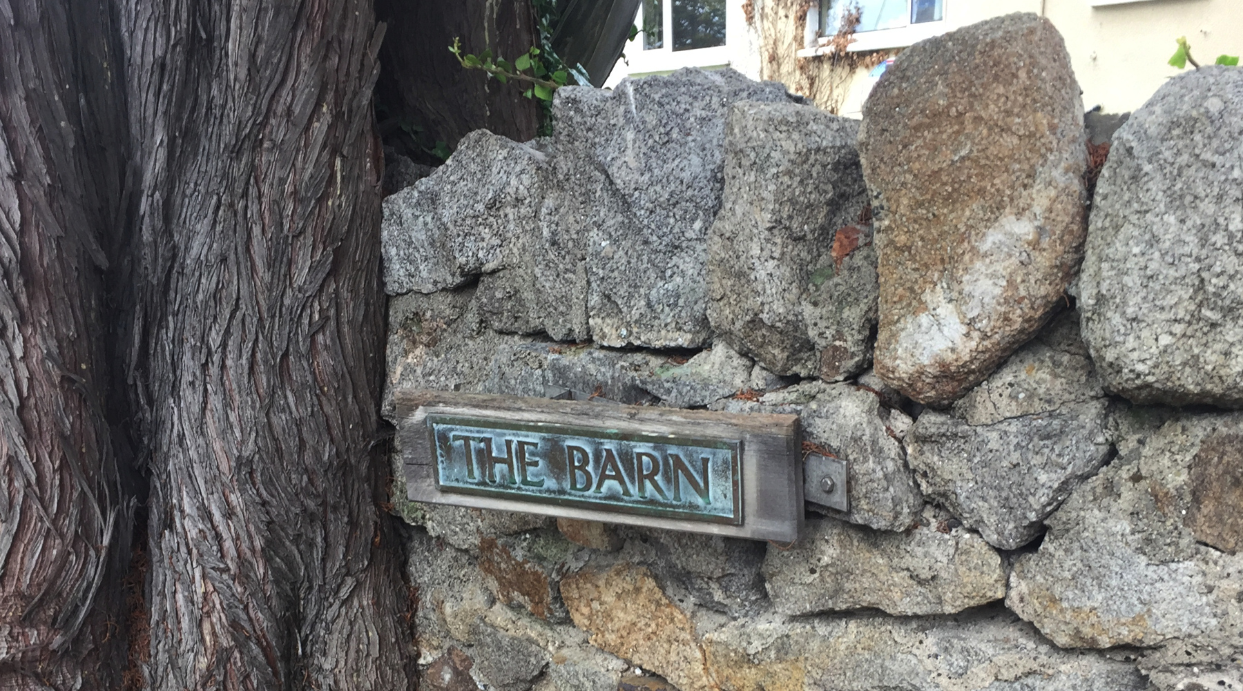
Through the next driveway we see "The Barn" house on the right and another house sine nomine on the left that is also within the site of the reservoir. There's nothing to see here except the horizontal wood slats that were in the view from the bridge.
It is probably coincidence... but the top of the wall is different at the spot where I think the Shed was, the station of the atmospheric railway. I'm pretty sure that top is newer than the rest, but why did it need to be replaced? A mystery. This wall is not part of the double track rebuild, so it is either from atmospheric days or the first rebuild. That's all I can say.
(The lighting on these photographs varies because the cloud cover was changing rapidly on this October day. The two below were taken about an hour apart.)
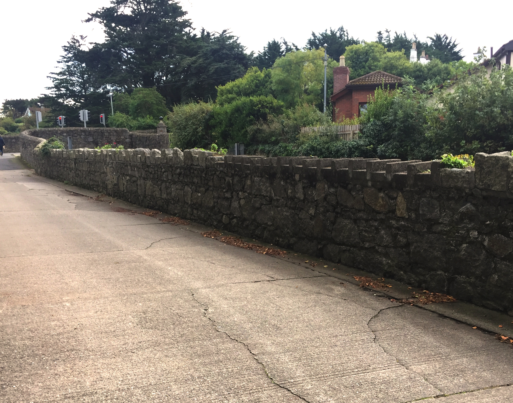
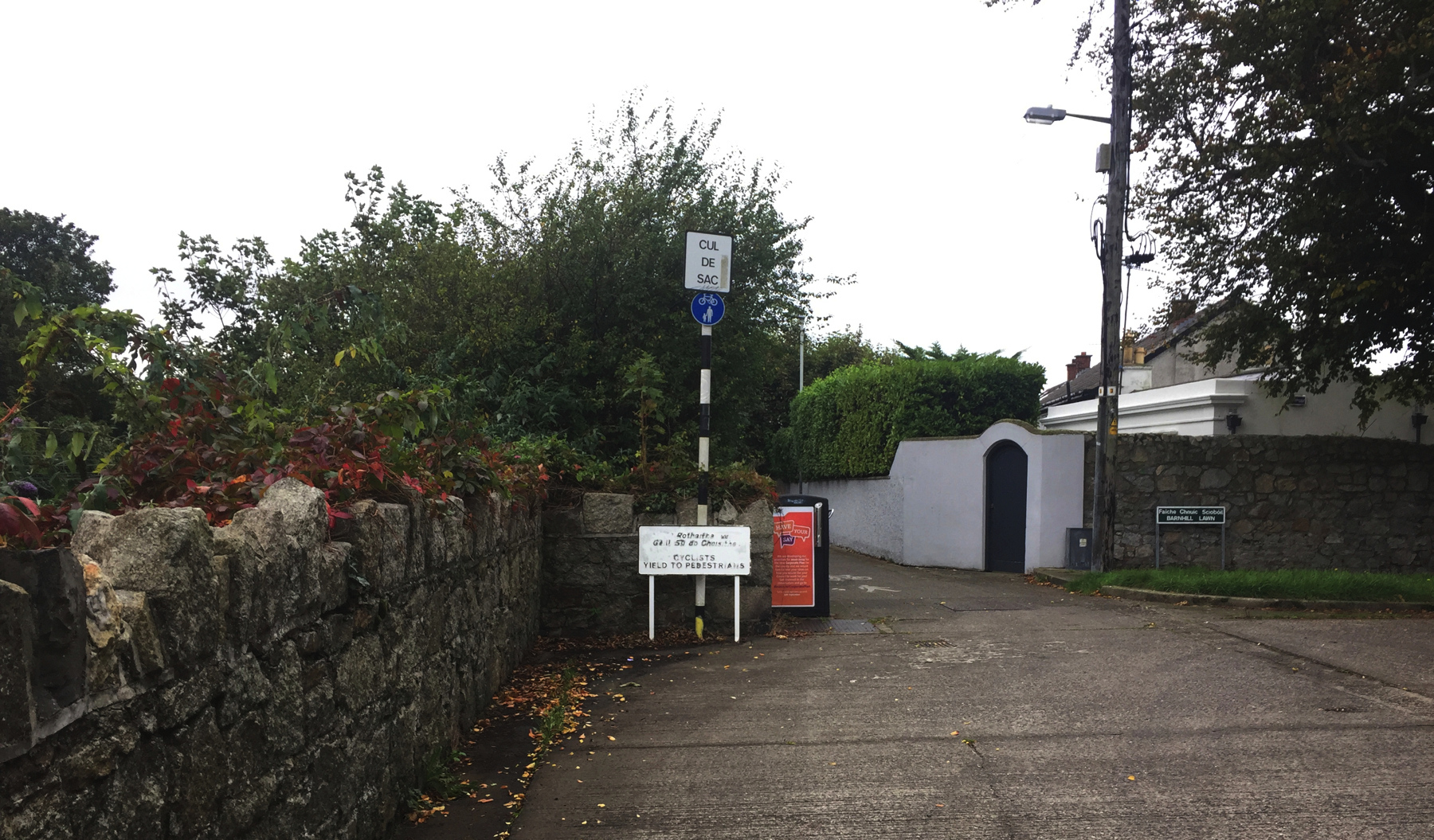
Here we come to the end of motor traffic at a jog in the wall that corresponds to the west end of the engine house property. The jog is visible on the 1888 Ordnance Survey map. I include the blurry picture here because it shows in one view the possible site of the Shed, the wood slats, the white wall, and the jog in the stone wall. At the jog a road called Barnhill Lawn runs off to the right, but it doesn't go anywhere, being a dead end, or more politely, a cul de sac (bag end).
Below, the view from Barnhill Lawn. Check the previous photograph: the jog is at the black and white post. The difference in the wall construction is very slight.
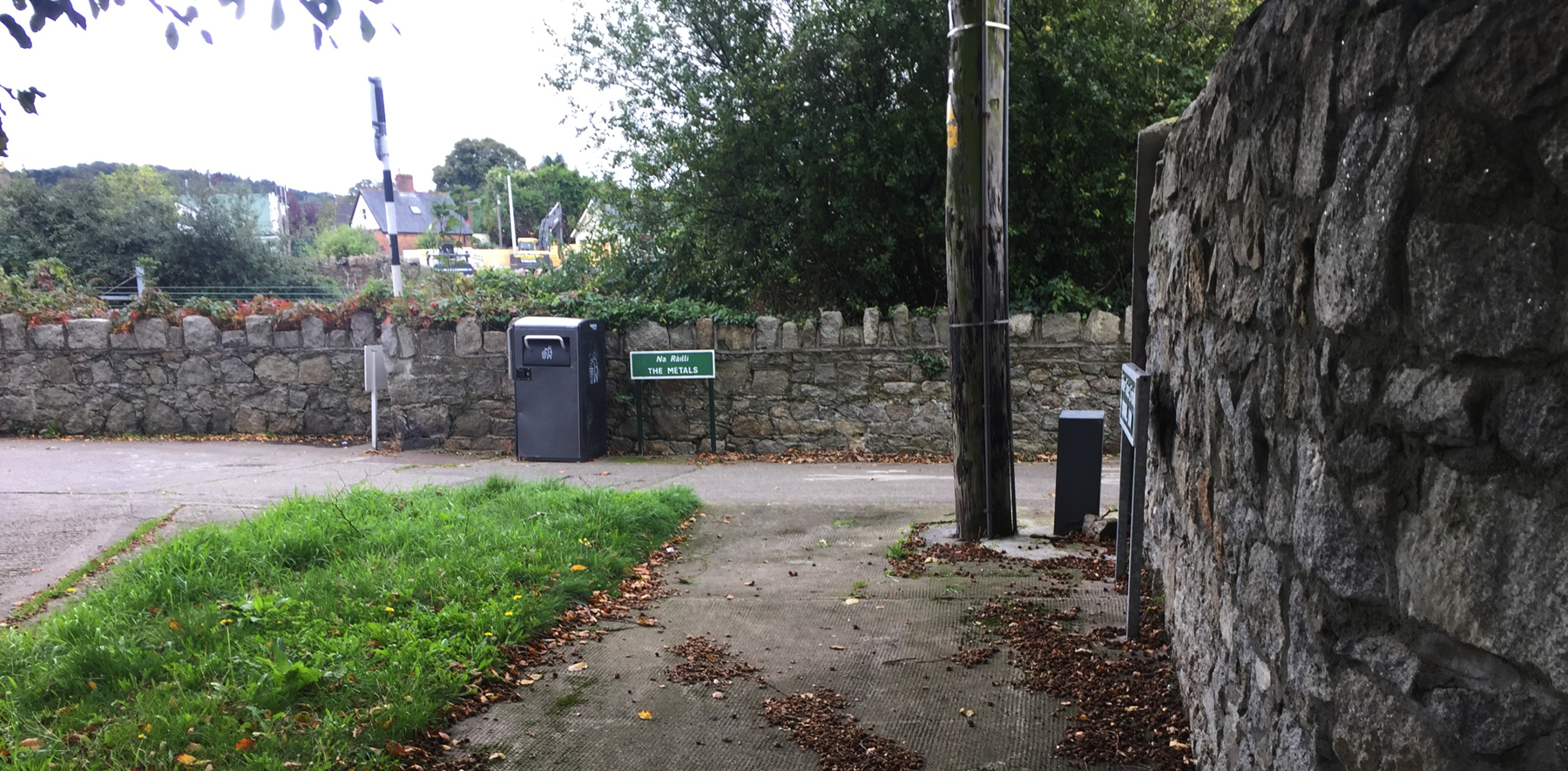
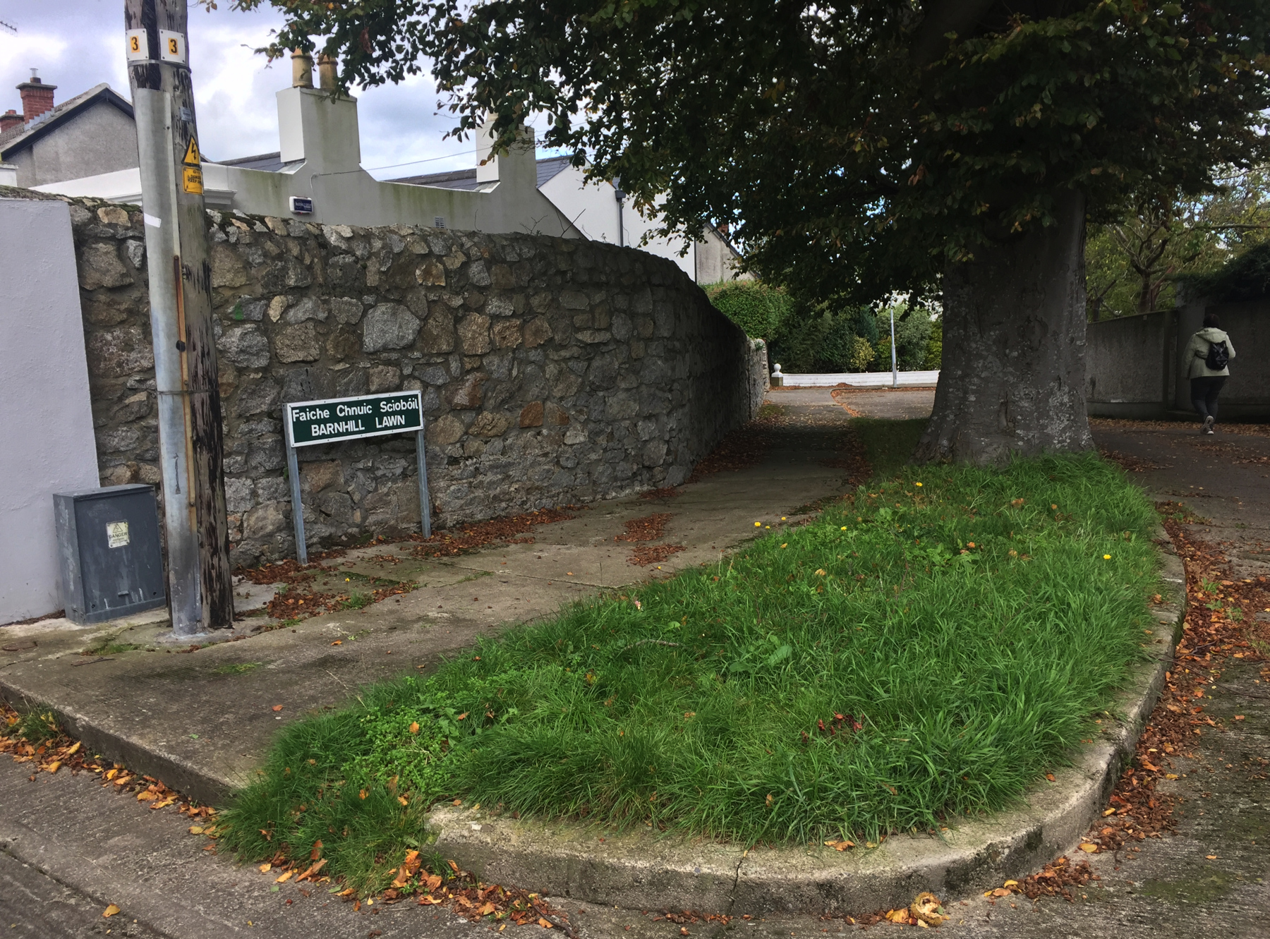
Before we go, here is a look down Barnhill Lawn. The wall on the left is on the line of the west end of the atmospheric property. It even has the same change of direction after a short distance. The person walking is on the site of the engine house. Nothing is left here. In the distance before the wall ends is a gate marked Hawthorns, a name seen on the 1888 map for buildings a little farther away.
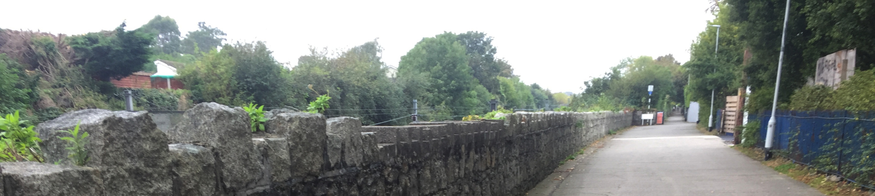
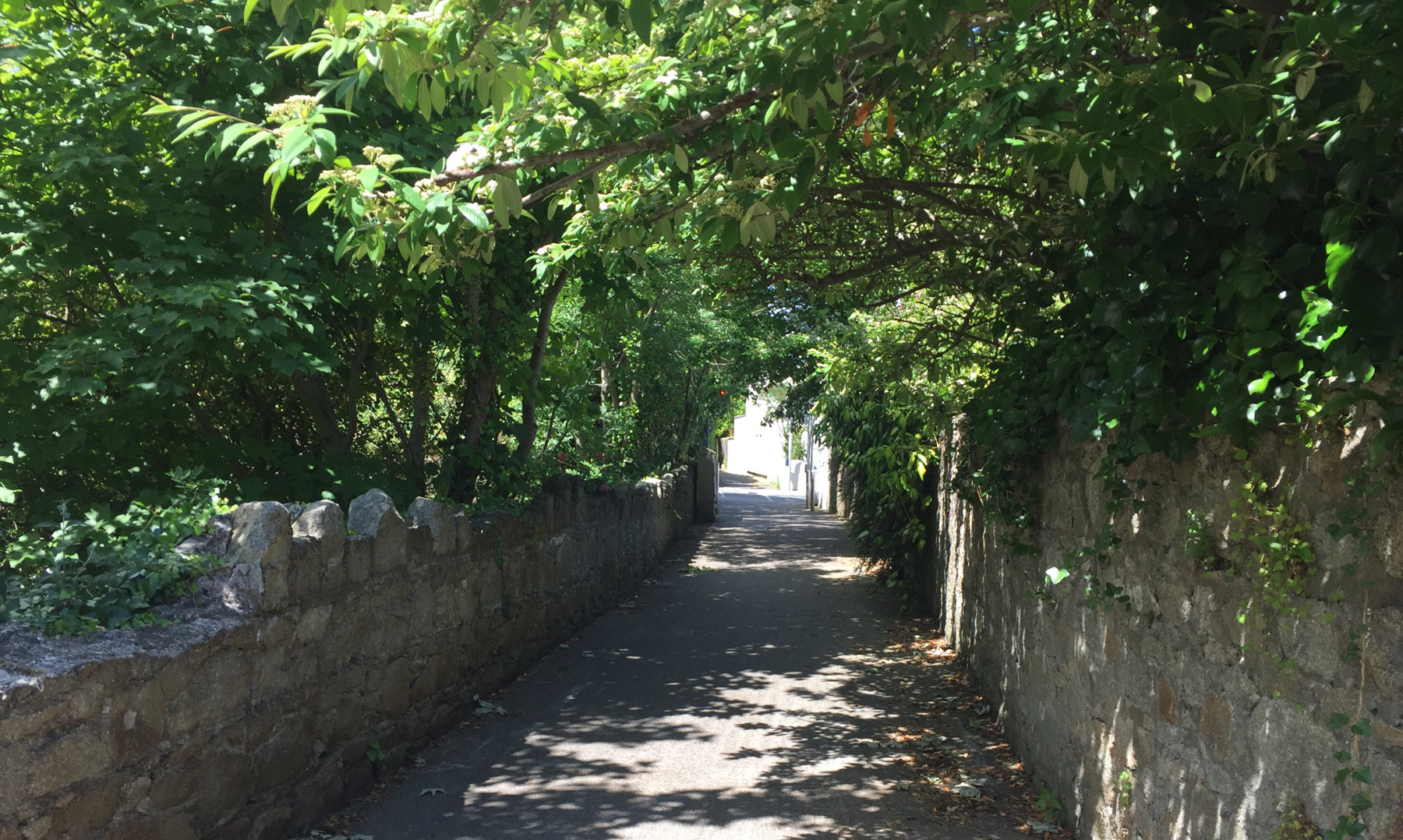
At this point Na Ráillí, The Metals, resumes after its interruption by Atmospheric Road. It runs between walls, the old railway cut on the west side and the paranoid houses of Gosworth Park on the east. It's worth going up to Castle Park Road to see the old arch bridge. If we assume that the conversion to locomotive working required only lowering the floor but keeping the same bridges, and we know that this is the only bridge that was not removed to make way for a double track bridge (since it is the only place where the double track bridge is at a different location), then aside from some uncertain sections of wall that may have been retained during the double tracking— given all that— then the Castle Park Road stone arch bridge is the most certain work of the Dalkey atmospheric railway that is still in existence.
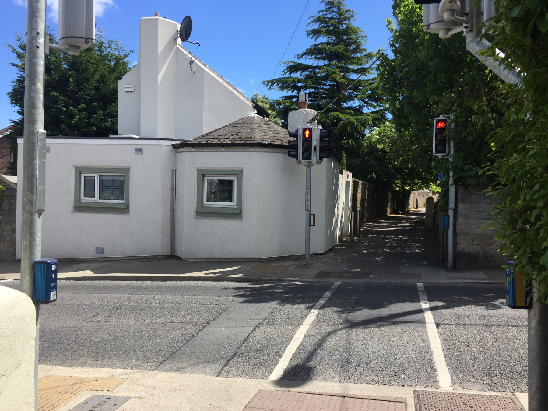
Below, we approach Castle Park Road in June. A red traffic signal shows through a distant tree. The Metals and the wall next to the railway has started to make a gentle curve to the left. The lush greenery in the old railway cut totally blocked all view to anything below.
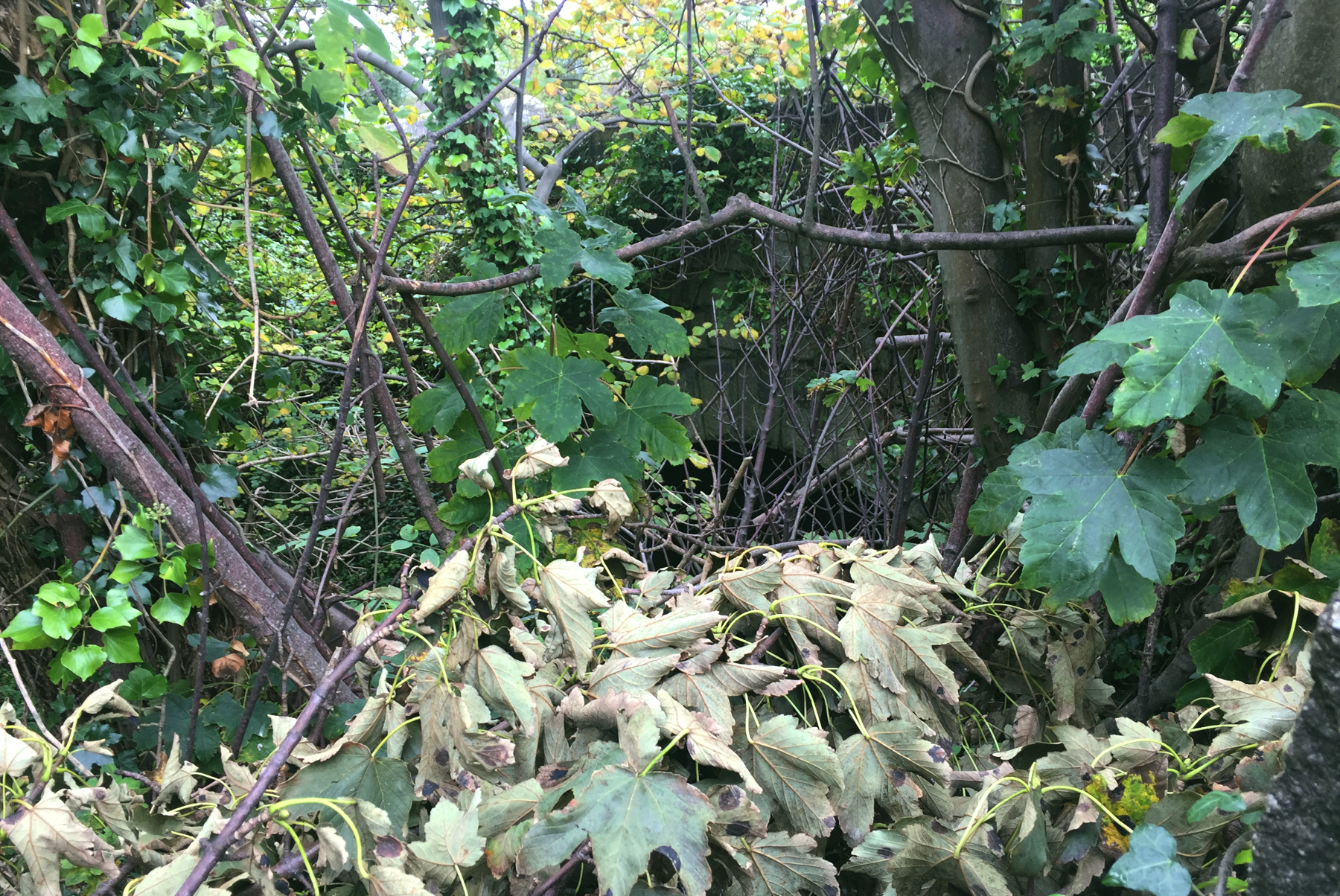
But in October... it was better, not much, but better. I managed to see the arch of the single-track bridge. I suppose I could (a) go back in mid winter when more leaves are gone or (b) bring a ladder and an assistant and waterproof boots, and go over the the stone wall, or (c) both. I have no such plans, so the snaps below will have to do. It's near the middle of each picture.

Two men were working on the roof of a house oppposite and they saw me taking pictures. I said hello and asked whether they had seen the arched bridge. They said they had not, and I suggested they take a look when they come down. Secretly I hoped there was a good view of it from where they were, and so they would invite me up if the boss was not around. That did not happen. No hard feelings.
So I think this bridge is original to the atmospheric railway, and if the local authorities would have someone come and clear the brush regularly just here in this immediate area, it wouldn't cost much and it would make a nice local landmark. I fear though that doing so would attract idiots to come paint graffiti on the bridge. Maybe it's better this way.
As I mentioned the cut is filled in on the north side, so you can't walk through. There must be a solid wall near the other side of the arch. I don't know how often the public works people check the condition of the bridge. It's 177 years old as I write this, so it would be worth a look once in a while since there is a public road crossing over. But stone arches can last for centuries.
I don't want to forget the crossing house at Castle Park Road that I mentioned. The 1888 map shows it as rounded lump with a short straight section along Castle Park Road. Here it is in 2018, with a taller addition behind it.
As you can see The Metals is very well maintained, with its own crossing signals that respond immediately when pedestrians push the button to stop motor traffic. It's like this all the way down to Sandycove. The stone wall here near the corner has had some relatively recent repairs for short distances. I have read that some of the road bridges were rebuilt around 1980 to get clearance for the overhead wires for the DART trains. I don't know whether the main line bridge here is one of them.
From this spot it's about the same distance to Glenageary or Dalkey stations, but Dalkey is a quaint old town, so I liked that better. There are some small castles for which the street is named, a museum, and places to get a bite.
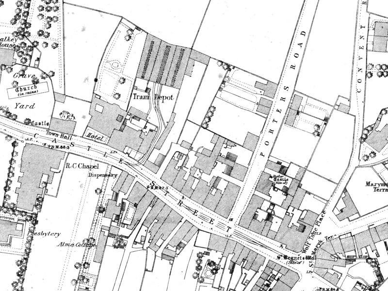
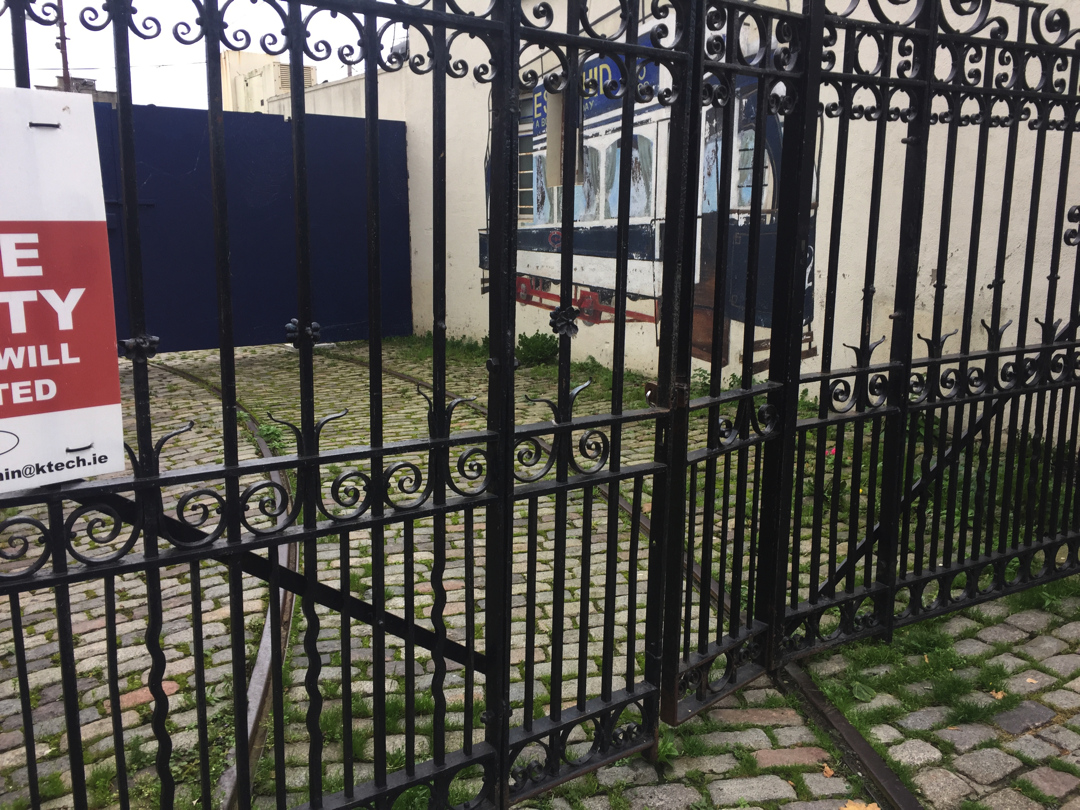
I noticed along Castle Street a yard between buildings with a curved streetcar track leading in. The 1888 Ordnance Survey map confirms that it was where a Tram Depot was. Until 1949 the electric cars ran from the middle of Dublin to the intersection down the street at the corner of Wolf Tone Place near the ruins of St Begnet's church. The red sign warned me not to try to go in, and I felt that if I did the angels would punish me. I wonder what's beyond the dark blue doors back there.